Geolocate

Les Passadoires topographic map

Click on the map to display elevation.

About this map
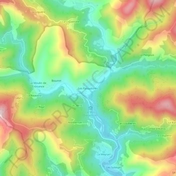
Name: Les Passadoires topographic map, elevation, terrain.

Location: Les Passadoires, Saint-Étienne-Vallée-Française, Florac, Lozère, Occitanie, France métropolitaine, 48330, France (44.16781 3.81467 44.20781 3.85467)

Average elevation: 408 m

Minimum elevation: 239 m

Maximum elevation: 651 m

Other topographic maps

Click on a map to view its topography, its elevation and its terrain.
Gear up for your next adventure:

🔪Outdoor Multitool - Versatile tool for repairs and food prep in the wild
🍽️Titanium Camping Spork - Ultralight and indestructible eating utensil
🧦Hiking Liner Socks - Thin base layer to prevent friction and blisters
🦯Trekking Poles - Reduced impact on joints for steep topographic climbs
🧦Thermal Socks - Warm socks for winter hiking or camping

As an Amazon Associate, this site earns from qualifying purchases at no extra cost to you.