Geolocate

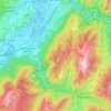
Carlinière topographic map

Click on the map to display elevation.

About this map

Name: Carlinière topographic map, elevation, terrain.

Location: Carlinière, Saint-Pierre-de-Chartreuse, Grenoble, Isère, Auvergne-Rhône-Alpes, France métropolitaine, 38380, France (45.32440 5.79065 45.36440 5.83065)

Average elevation: 1,092 m

Minimum elevation: 709 m

Maximum elevation: 1,736 m

Other topographic maps

Click on a map to view its topography, its elevation and its terrain.
Gear up for your next adventure:

🏃Hydration Running Vest - Carry water and maps close to your body for speed
🚑Survival Whistle - Signal for help across long distances in mountains
💡LED Headlamp - Hands-free illumination for night hiking and camping
🧦Hiking Socks - Moisture-wicking and comfortable socks for long hikes
🧭GPS Tracker - Track your location in remote areas safely

As an Amazon Associate, this site earns from qualifying purchases at no extra cost to you.