
Chesterfield topographic map
Interactive map
Click on the map to display elevation.
About this map
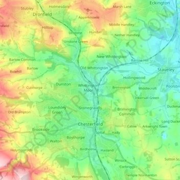
Name: Chesterfield topographic map, elevation, terrain.
Location: Chesterfield, Derbyshire, East Midlands, Engeland, VK (53.21242 -1.48429 53.29902 -1.30130)
Average elevation: 127 m
Minimum elevation: 41 m
Maximum elevation: 305 m