Geolocate

Catanauan topographic map

Click on the map to display elevation.

About this map

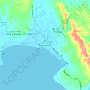
Name: Catanauan topographic map, elevation, terrain.

Location: Catanauan, Quezon, Calabarzon, 4311, Philippines (13.55298 122.28231 13.63298 122.36231)

Average elevation: 27 m

Minimum elevation: 0 m

Maximum elevation: 177 m

Gear up for your next adventure:

🛰️Satellite Messenger - Emergency communication for areas with no cell service
🔪Outdoor Multitool - Versatile tool for repairs and food prep in the wild
🚲Handlebar Phone Mount - View topographic-map.com live while cycling
🧴Outdoor Sunscreen - High SPF protection for high-altitude UV exposure
🥾All-Terrain Hiking Boots - Versatile boots for varied hiking conditions

As an Amazon Associate, this site earns from qualifying purchases at no extra cost to you.