
Thank you for supporting this site ❤️
Make a donation
Make a donation
Gear up for your next adventure:
As an Amazon Associate, this site earns from qualifying purchases at no extra cost to you.
Zangolo topographic map
Click on the map to display elevation.
Thank you for supporting this site ❤️
Make a donation
Make a donation
Gear up for your next adventure:
As an Amazon Associate, this site earns from qualifying purchases at no extra cost to you.
About this map
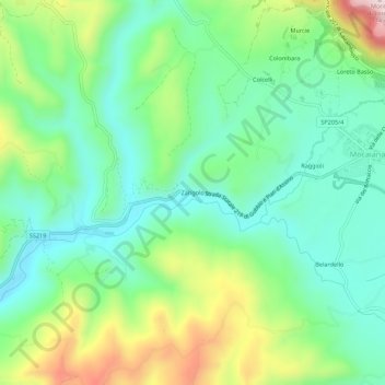
Name: Zangolo topographic map, elevation, terrain.
Location: Zangolo, Gubbio, Perugia, Umbrië, 06024, Italië (43.35561 12.45283 43.39561 12.49283)
Average elevation: 481 m
Minimum elevation: 350 m
Maximum elevation: 765 m
Thank you for supporting this site ❤️
Make a donation
Make a donation
Gear up for your next adventure:
As an Amazon Associate, this site earns from qualifying purchases at no extra cost to you.