Geolocate

Keene topographic map

Click on the map to display elevation.

About this map

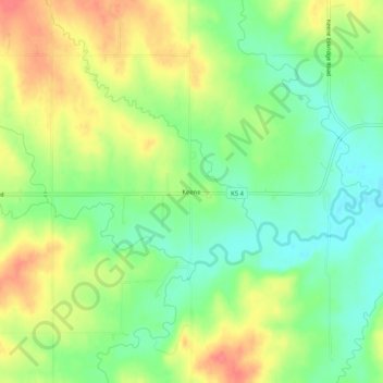
Name: Keene topographic map, elevation, terrain.

Location: Keene, Wabaunsee County, Kansas, United States (38.93750 -96.05916 38.97750 -96.01916)

Average elevation: 355 m

Minimum elevation: 326 m

Maximum elevation: 389 m

Gear up for your next adventure:

🥾Durable Hiking Shoes - Long-lasting shoes for frequent hiking
🧊Portable Cooler - Keep food and drinks cold during outdoor adventures
Tent Footprint - Protect tent floor and increase durability
🧦Merino Wool Socks - Moisture-wicking comfort for long-distance hiking
🎒Backpack Rain Cover - External shield to keep your entire pack dry

As an Amazon Associate, this site earns from qualifying purchases at no extra cost to you.