Geolocate

Carzoá topographic map

Click on the map to display elevation.

About this map

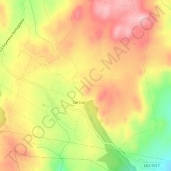
Name: Carzoá topographic map, elevation, terrain.

Location: Carzoá, Cualedro, Verín, Orense, Galicia, 32689, España (41.95319 -7.60178 41.98152 -7.56746)

Average elevation: 856 m

Minimum elevation: 728 m

Maximum elevation: 946 m

Gear up for your next adventure:

👟Sport Hiking Sandals - Breathable footwear for water crossings and camp rest
🗺️Topographic Maps - Detailed maps to explore trails, mountains, and wilderness areas
🌡️Emergency Mylar Blankets - Compact thermal protection for unexpected nights outdoors
💧Hydration Pack - Hands-free hydration system for long hikes
🥾Approach Boots - Comfortable boots for hiking and climbing approaches

As an Amazon Associate, this site earns from qualifying purchases at no extra cost to you.