Geolocate

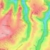
Jugiong topographic map

Click on the map to display elevation.

About this map
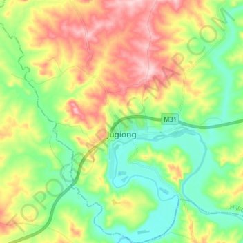
Name: Jugiong topographic map, elevation, terrain.

Location: Jugiong, Hilltops Council, New South Wales, 2726, Australia (-34.87162 148.28068 -34.76285 148.38669)

Average elevation: 317 m

Minimum elevation: 234 m

Maximum elevation: 444 m

Other topographic maps

Click on a map to view its topography, its elevation and its terrain.
Rose Seidler House

Australia > New South Wales > Sydney

Average elevation: 153 m

Mount Annan

Australia > New South Wales > Sydney

Average elevation: 115 m

Herron Park

Australia > New South Wales > Sydney

Average elevation: 28 m

Dark Gully Reserve

Australia > New South Wales > Sydney

Average elevation: 14 m

Grafton

Australia > New South Wales

Average elevation: 36 m

Castle Mountain

Australia > New South Wales > Quirindi

Average elevation: 578 m

Poley Mountain

Australia > New South Wales

Average elevation: 465 m

Comara

Australia > New South Wales

Average elevation: 909 m

Gear up for your next adventure:

💧Filtered Water Bottle - Safe drinking water on the go
🥾Light Trekking Boots - Supportive boots for multi-day treks
🔦LED Flashlight - Powerful and long-lasting flashlight for camping and emergencies
🥾Durable Hiking Shoes - Long-lasting shoes for frequent hiking
⛺Camping Groundsheet - Protect your tent from moisture and dirt

As an Amazon Associate, this site earns from qualifying purchases at no extra cost to you.