Geolocate

Basoda topographic map

Click on the map to display elevation.

About this map

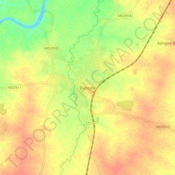
Name: Basoda topographic map, elevation, terrain.

Location: Basoda, Basoda Tahsil, Vidisha, Madhya Pradesh, 464221, India (23.80809 77.90147 23.88809 77.98147)

Average elevation: 416 m

Minimum elevation: 389 m

Maximum elevation: 431 m

Gear up for your next adventure:

🥾Trekking Poles - Adjustable trekking poles to reduce knee stress and improve stability
🧶550 Survival Paracord - Versatile utility cord for emergency repairs and rigging
🧢Outdoor Visor - Breathable visor for sunny hikes
Camping Groundsheet - Protect your tent from moisture and dirt
Camping Essentials - All-in-one gear for a comfortable camping trip

As an Amazon Associate, this site earns from qualifying purchases at no extra cost to you.