Geolocate

Sunampe topographic map

Click on the map to display elevation.

About this map

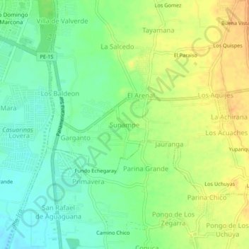
Name: Sunampe topographic map, elevation, terrain.

Location: Sunampe, Los Aquijes, Provincia de Ica, Ica, ICA01, Perú (-14.12128 -75.72623 -14.08128 -75.68623)

Average elevation: 405 m

Minimum elevation: 389 m

Maximum elevation: 423 m

Gear up for your next adventure:

🛶Kayak Dry Bag - Waterproof storage for kayaking adventures
🪜Heavy Duty Carabiners - Multi-use clips for securing gear to your backpack
🦶Anti-Blister Balm - Prevents friction and hotspots during long ascents
💧Hydration Pack - Hands-free hydration system for long hikes
🥾All-Terrain Hiking Boots - Versatile boots for varied hiking conditions

As an Amazon Associate, this site earns from qualifying purchases at no extra cost to you.