
Thank you for supporting this site ❤️
Make a donation
Make a donation
Gear up for your next adventure:
As an Amazon Associate, this site earns from qualifying purchases at no extra cost to you.
Calabazas topographic map
Click on the map to display elevation.
Thank you for supporting this site ❤️
Make a donation
Make a donation
Gear up for your next adventure:
As an Amazon Associate, this site earns from qualifying purchases at no extra cost to you.
About this map
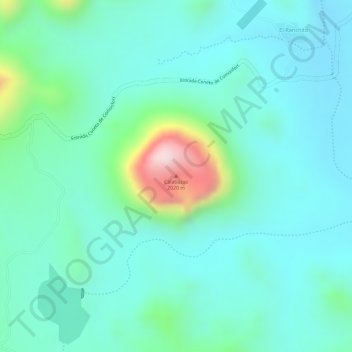
Name: Calabazas topographic map, elevation, terrain.
Location: Calabazas, Coneto de Comonfort, Durango, Mexico (24.94193 -104.62603 24.94203 -104.62593)
Average elevation: 1,729 m
Minimum elevation: 1,646 m
Maximum elevation: 2,024 m
Thank you for supporting this site ❤️
Make a donation
Make a donation
Gear up for your next adventure:
As an Amazon Associate, this site earns from qualifying purchases at no extra cost to you.