Geolocate

Mitú topographic map

Click on the map to display elevation.

About this map

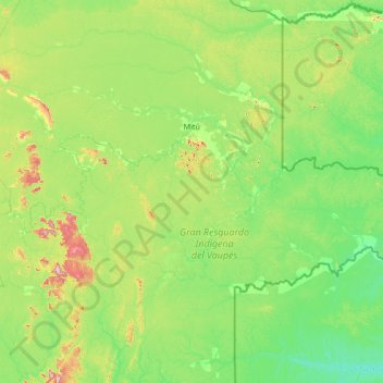
Name: Mitú topographic map, elevation, terrain.

Location: Mitú, Vaupés, Amazonia, Colombia (0.15160 -71.11861 1.79101 -69.84266)

Average elevation: 190 m

Minimum elevation: 88 m

Maximum elevation: 617 m

Other topographic maps

Click on a map to view its topography, its elevation and its terrain.

San Antonio

Colombia > Vaupés > Mitú

Average elevation: 206 m

Gear up for your next adventure:

🧦Hiking Liner Socks - Thin base layer to prevent friction and blisters
🧭Orienteering Kit - Tools for map reading and navigation in the wild
🏕️Camping Hammock - Integrated protection for sleeping between trees
🛶Canoe Life Vest - Safety vest for water sports
🧊Insulated Water Bottle - Keeps drinks cold in summer and prevents freezing in winter

As an Amazon Associate, this site earns from qualifying purchases at no extra cost to you.