
Ravels topographic map
Interactive map
Click on the map to display elevation.
About this map
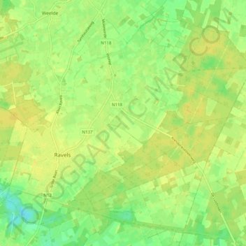
Name: Ravels topographic map, elevation, terrain.
Location: Ravels, Turnhout, Anvers, 2380, Belgique (51.35273 4.97216 51.40685 5.07118)
Average elevation: 30 m
Minimum elevation: 18 m
Maximum elevation: 36 m