
Thank you for supporting this site ❤️
Make a donation
Make a donation
Gear up for your next adventure:
As an Amazon Associate, this site earns from qualifying purchases at no extra cost to you.
Guayllabamba topographic map
Click on the map to display elevation.
Thank you for supporting this site ❤️
Make a donation
Make a donation
Gear up for your next adventure:
As an Amazon Associate, this site earns from qualifying purchases at no extra cost to you.
About this map
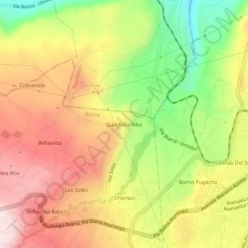
Name: Guayllabamba topographic map, elevation, terrain.
Location: Guayllabamba, San Antonio, Ibarra, Imbabura, 100157, Ecuador (0.33405 -78.17835 0.37405 -78.13835)
Average elevation: 2,217 m
Minimum elevation: 1,983 m
Maximum elevation: 2,418 m
Thank you for supporting this site ❤️
Make a donation
Make a donation
Gear up for your next adventure:
As an Amazon Associate, this site earns from qualifying purchases at no extra cost to you.