
Ras Sajir topographic map
Interactive map
Click on the map to display elevation.
About this map
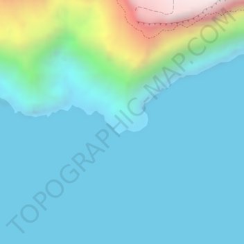
Name: Ras Sajir topographic map, elevation, terrain.
Location: Ras Sajir, Dhofar, Oman (16.74000 53.57375 16.76000 53.59375)
Average elevation: 159 m
Minimum elevation: -7 m
Maximum elevation: 908 m
Other topographic maps
Click on a map to view its topography, its elevation and its terrain.
Shamal Madinat as Saadah
Shamal Madinat as Saadah, Salalah, Dhofar, Oman
Average elevation: 32 m