
Los Silos topographic map
Interactive map
Click on the map to display elevation.
About this map
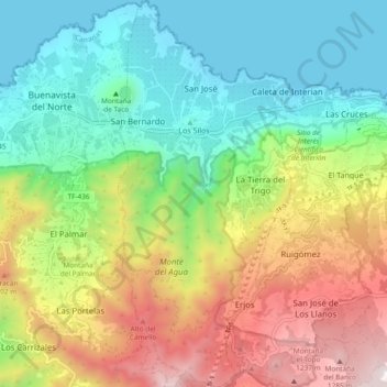
Name: Los Silos topographic map, elevation, terrain.
Location: Los Silos, Santa Cruz de Tenerife, Canarias, España (28.31088 -16.83524 28.39362 -16.79311)
Average elevation: 503 m
Minimum elevation: 0 m
Maximum elevation: 1,377 m