
Götzer Berg topographic map
Interactive map
Click on the map to display elevation.
About this map
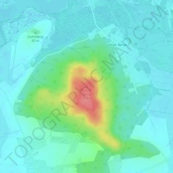
Name: Götzer Berg topographic map, elevation, terrain.
Average elevation: 42 m
Minimum elevation: 26 m
Maximum elevation: 102 m
Other topographic maps
Click on a map to view its topography, its elevation and its terrain.
Telegraphenberg
Deutschland > Brandenburg > Groß Kreutz (Havel)
Telegraphenberg, Groß Kreutz (Havel), Potsdam-Mittelmark, Brandenburg, 14550, Deutschland
Average elevation: 45 m
Golmberg
Deutschland > Brandenburg > Groß Kreutz (Havel)
Golmberg, Groß Kreutz (Havel), Potsdam-Mittelmark, Brandenburg, 14550, Deutschland
Average elevation: 37 m