
Joinville topographic map
Interactive map
Click on the map to display elevation.
About this map
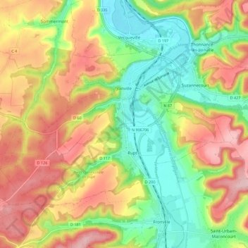
Name: Joinville topographic map, elevation, terrain.
Average elevation: 267 m
Minimum elevation: 175 m
Maximum elevation: 370 m
Other topographic maps
Click on a map to view its topography, its elevation and its terrain.
Ozières
França > Grande Leste > Haute-Marne > Ozières
Ozières, Chaumont, Haute-Marne, Grande Leste, França metropolitana, 52700, França
Average elevation: 423 m