
Santa Cruz topographic map
Interactive map
Click on the map to display elevation.
About this map
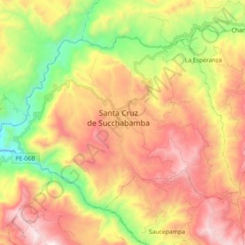
Name: Santa Cruz topographic map, elevation, terrain.
Location: Santa Cruz, Cajamarca, Peru (-6.67801 -79.01435 -6.57952 -78.87425)
Average elevation: 1,881 m
Minimum elevation: 1,118 m
Maximum elevation: 2,648 m