
Villamartín topographic map
Interactive map
Click on the map to display elevation.
About this map
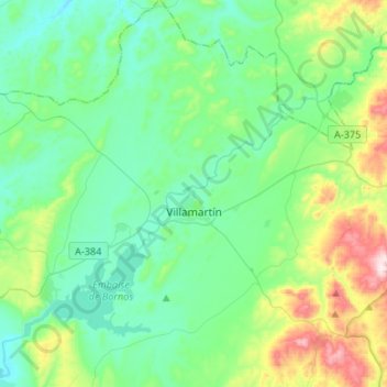
Name: Villamartín topographic map, elevation, terrain.
Location: Villamartín, Sierra de Cádiz, Cádiz, Andalusië, 11650, Spanje (36.76261 -5.73631 36.97599 -5.52320)
Average elevation: 189 m
Minimum elevation: 61 m
Maximum elevation: 625 m
Other topographic maps
Click on a map to view its topography, its elevation and its terrain.
Setenil de las Bodegas
Spanje > Andalusië > Sierra de Cádiz
Setenil de las Bodegas, Sierra de Cádiz, Cádiz, Andalusië, Spanje
Average elevation: 688 m
Prado del Rey
Spanje > Andalusië > Sierra de Cádiz
Prado del Rey, Sierra de Cádiz, Cádiz, Andalusië, 11660, Spanje
Average elevation: 313 m