
Make a donation
Gear up for your next adventure:
As an Amazon Associate, this site earns from qualifying purchases at no extra cost to you.
Río Holmul topographic map
Click on the map to display elevation.
Make a donation
Gear up for your next adventure:
As an Amazon Associate, this site earns from qualifying purchases at no extra cost to you.
About this map
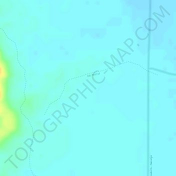
Name: Río Holmul topographic map, elevation, terrain.
Location: Río Holmul, Flores, Petén, Guatemala (17.25724 -89.51864 17.26539 -89.50040)
Average elevation: 212 m
Minimum elevation: 207 m
Maximum elevation: 233 m
Make a donation
Gear up for your next adventure:
As an Amazon Associate, this site earns from qualifying purchases at no extra cost to you.
Other topographic maps
Click on a map to view its topography, its elevation and its terrain.
Tikal
Guatemala > Petén > Flores > Zocotzal
The city has been completely mapped and covered an area greater than 16 square kilometers (6.2 sq mi) that included about 3,000 structures. The topography of the site consists of a series of parallel limestone ridges rising above swampy lowlands. The major architecture of the site is clustered upon areas of…
Average elevation: 261 m