
Thank you for supporting this site ❤️
Make a donation
Make a donation
Gear up for your next adventure:
As an Amazon Associate, this site earns from qualifying purchases at no extra cost to you.
Yıldırım topographic map
Click on the map to display elevation.
Thank you for supporting this site ❤️
Make a donation
Make a donation
Gear up for your next adventure:
As an Amazon Associate, this site earns from qualifying purchases at no extra cost to you.
About this map
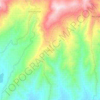
Name: Yıldırım topographic map, elevation, terrain.
Location: Yıldırım, Yenişehir, Bursa, Marmara Region, Turkey (40.30950 29.53854 40.34950 29.57854)
Average elevation: 494 m
Minimum elevation: 314 m
Maximum elevation: 756 m
Thank you for supporting this site ❤️
Make a donation
Make a donation
Gear up for your next adventure:
As an Amazon Associate, this site earns from qualifying purchases at no extra cost to you.