
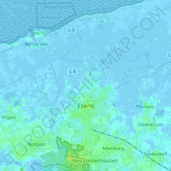
Esens topographic map
Interactive map
Click on the map to display elevation.
About this map
Name: Esens topographic map, elevation, terrain.
Average elevation: 1 m
Minimum elevation: -6 m
Maximum elevation: 9 m
Other topographic maps
Click on a map to view its topography, its elevation and its terrain.
Neugaude
Duitsland > Nedersaksen > Landkreis Wittmund > Moorweg
Neugaude, Moorweg, Samtgemeinde Esens, Landkreis Wittmund, Nedersaksen, Duitsland
Average elevation: 4 m
Spiekeroog
Duitsland > Nedersaksen > Landkreis Wittmund > Spiekeroog
Spiekeroog, Landkreis Wittmund, Nedersaksen, 26474, Duitsland
Average elevation: 0 m