Geolocate

Kunigami topographic map

Click on the map to display elevation.

About this map

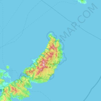
Name: Kunigami topographic map, elevation, terrain.

Location: Kunigami, Okinawa Prefecture, Japan (26.53648 128.05555 27.03868 128.55932)

Average elevation: 23 m

Minimum elevation: 0 m

Maximum elevation: 488 m

Gear up for your next adventure:

🩹Moleskin Blister Pads - Direct protection for painful foot pressure points
🛏️Camping Sleeping Mat - Comfortable mats for sleeping outdoors
🧥Packable Rain Jacket - Breathable waterproof layer for unpredictable weather
🧭GPS Handheld Device - Reliable GPS navigation for outdoor adventures
🧥Waterproof Hiking Jacket - Protect yourself from rain and wind while hiking

As an Amazon Associate, this site earns from qualifying purchases at no extra cost to you.