Geolocate

Xichuan topographic map

Click on the map to display elevation.

About this map

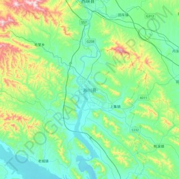
Name: Xichuan topographic map, elevation, terrain.

Location: Xichuan, Xichuan County, Nanyang City, Henan, China (32.97796 111.32205 33.29796 111.64205)

Average elevation: 327 m

Minimum elevation: 144 m

Maximum elevation: 965 m

Gear up for your next adventure:

🪜Heavy Duty Carabiners - Multi-use clips for securing gear to your backpack
🧴Outdoor Sunscreen - High SPF protection for high-altitude UV exposure
🎒Hiking Backpack - Lightweight and ergonomic backpacks for day hikes or multi-day treks
🧥Fleece Jacket - Warm and lightweight jacket for layering
💧Reusable Water Bottle - Durable water bottles for hydration on trails

As an Amazon Associate, this site earns from qualifying purchases at no extra cost to you.