Geolocate

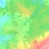
Caro topographic map

Click on the map to display elevation.

About this map

Name: Caro topographic map, elevation, terrain.

Location: Caro, Vannes, Morbihan, Brittany, Metropolitan France, 56140, France (47.83228 -2.40034 47.89823 -2.26934)

Average elevation: 80 m

Minimum elevation: 15 m

Maximum elevation: 136 m

Other topographic maps

Click on a map to view its topography, its elevation and its terrain.
Tréhuinec

France > Brittany > Morbihan > Vannes

Average elevation: 37 m

Comper

France > Brittany > Morbihan > Concoret

Average elevation: 116 m

Kerflem

France > Brittany > Morbihan > Caudan

Average elevation: 33 m

Cornaud

France > Brittany > Morbihan > Saint-Gildas-de-Rhuys > Cornaud

Average elevation: 15 m

Gear up for your next adventure:

🔨Vehicle Emergency Tool - Safety tool for remote road trips to trailheads
🛌Down Sleeping Bag - Superior warmth-to-weight ratio for cold nights
🔥Camping Stove - Portable stoves to cook outdoors with ease
🧢Outdoor Visor - Breathable visor for sunny hikes
🥾Hiking Shoes - Durable and comfortable shoes for trail hiking

As an Amazon Associate, this site earns from qualifying purchases at no extra cost to you.