Geolocate

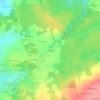
Caro topographic map

Click on the map to display elevation.

About this map

Name: Caro topographic map, elevation, terrain.

Location: Caro, Vannes, Morbihan, Brittany, Metropolitan France, 56140, France (47.83228 -2.40034 47.89823 -2.26934)

Average elevation: 80 m

Minimum elevation: 15 m

Maximum elevation: 136 m

Other topographic maps

Click on a map to view its topography, its elevation and its terrain.
Tréhuinec

France > Brittany > Morbihan > Vannes

Average elevation: 37 m

Comper

France > Brittany > Morbihan > Concoret

Average elevation: 116 m

Cornaud

France > Brittany > Morbihan > Saint-Gildas-de-Rhuys > Cornaud

Average elevation: 15 m

Kerflem

France > Brittany > Morbihan > Caudan

Average elevation: 33 m

Gear up for your next adventure:

💡Portable Camping Lamp - Rechargeable lamp for campsite lighting
📷Outdoor Action Camera - Capture high-elevation views and rugged adventures
🥾Mountaineering Boots - Supportive boots for climbing and high-altitude hiking
🔭Outdoor Binoculars - Lightweight binoculars for birdwatching and hiking
👟Trail Running Shoes - Agile footwear for fast-paced topographic exploration

As an Amazon Associate, this site earns from qualifying purchases at no extra cost to you.