Geolocate

Burnett topographic map

Click on the map to display elevation.

About this map

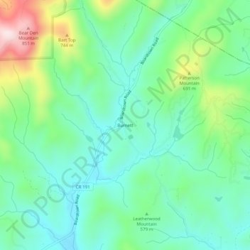
Name: Burnett topographic map, elevation, terrain.

Location: Burnett, Gilmer County, Georgia, United States (34.80369 -84.42715 34.84369 -84.38715)

Average elevation: 578 m

Minimum elevation: 456 m

Maximum elevation: 889 m

Gear up for your next adventure:

🧴Waterproofing Spray - Restore the DWR coating on jackets and tents
🔥Emergency Fire Starter - Reliable ignition source for all weather conditions
🧦Hiking Liner Socks - Thin base layer to prevent friction and blisters
💧Hydration Bladder - Hands-free hydration solution for long treks
🥾Approach Boots - Comfortable boots for hiking and climbing approaches

As an Amazon Associate, this site earns from qualifying purchases at no extra cost to you.