
Thank you for supporting this site ❤️
Make a donation
Make a donation
Gear up for your next adventure:
As an Amazon Associate, this site earns from qualifying purchases at no extra cost to you.
Sansal topographic map
Click on the map to display elevation.
Thank you for supporting this site ❤️
Make a donation
Make a donation
Gear up for your next adventure:
As an Amazon Associate, this site earns from qualifying purchases at no extra cost to you.
About this map
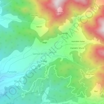
Name: Sansal topographic map, elevation, terrain.
Location: Sansal, Baijnath, Kangra, Himachal Pradesh, 176077, India (32.04689 76.67632 32.08689 76.71632)
Average elevation: 1,490 m
Minimum elevation: 1,151 m
Maximum elevation: 2,100 m
Thank you for supporting this site ❤️
Make a donation
Make a donation
Gear up for your next adventure:
As an Amazon Associate, this site earns from qualifying purchases at no extra cost to you.