Geolocate

Sendhwa topographic map

Click on the map to display elevation.

Sendhwa

Sendhwa is located at MH&MP Border 21°41′N 75°06′E / 21.68°N 75.1°E / 21.68; 75.1. It has an average elevation of 409 metres (1341 feet).

Wikipedia (CC-BY-SA 3.0)

About this map

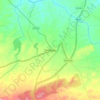
Name: Sendhwa topographic map, elevation, terrain.

Location: Sendhwa, Sendhwa Tahsil, Barwani, Madhya Pradesh, 451666, India (21.64707 75.05203 21.72707 75.13203)

Average elevation: 409 m

Minimum elevation: 353 m

Maximum elevation: 499 m

Gear up for your next adventure:

🧴Bear Spray Holster - Quick-access carry for essential Canadian wilderness safety
🥾Lightweight Hiking Shoes - Comfortable shoes for day hikes
🎒Backpack Rain Cover - External shield to keep your entire pack dry
🧭Orienteering Kit - Tools for map reading and navigation in the wild
🥾Waterproof Hiking Boots - Essential footwear for rugged terrain and wet Canadian trails

As an Amazon Associate, this site earns from qualifying purchases at no extra cost to you.