Geolocate

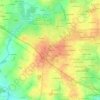
Guipry-Messac topographic map

Click on the map to display elevation.

About this map

Name: Guipry-Messac topographic map, elevation, terrain.

Location: Guipry-Messac, Redon, Ille-et-Vilaine, Brittany, Metropolitan France, 35480, France (47.76209 -1.91771 47.88940 -1.74602)

Average elevation: 49 m

Minimum elevation: 3 m

Maximum elevation: 125 m

Other topographic maps

Click on a map to view its topography, its elevation and its terrain.
La Teillais

France > Brittany > Ille-et-Vilaine > Pacé

Average elevation: 52 m

Le District

France > Brittany > Ille-et-Vilaine > Betton

Average elevation: 63 m

Les Planches

France > Brittany > Ille-et-Vilaine > Laillé

Average elevation: 73 m

Gear up for your next adventure:

🧥Packable Rain Jacket - Breathable waterproof layer for unpredictable weather
🥾Lightweight Hiking Boots - Boots for comfort and mobility on long hikes
🚲Bike Repair Kit - Essential tools for on-trail mechanical issues
🛏️Camping Sleeping Mat - Comfortable mats for sleeping outdoors
🥾Trekking Boots - Durable boots for long-distance trekking

As an Amazon Associate, this site earns from qualifying purchases at no extra cost to you.