
Babadağ topographic map
Click on the map to display elevation.
Babadağ
The mountain has a principal summit at an elevation of 1,969 metres (6,460 ft) and a second one called "Karatepe" at an elevation of 1,400 metres (4,593 ft). These two summits face each other and are separated by a flood valley, which led to the term "mountain range" to be used in some sources in association with Babadağ. The mass is composed mainly of limestone. It is noted for its rich flora, including the endemic Acer undulatum, and forests of Lebanon cedar (Cedrus libani).
About this map
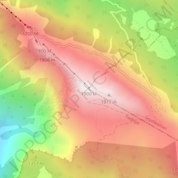
Name: Babadağ topographic map, elevation, terrain.
Location: Babadağ, Seydikemer, Muğla, Aegean Region, 48380, Turkey (36.53028 29.18089 36.53038 29.18099)
Average elevation: 1,463 m
Minimum elevation: 745 m
Maximum elevation: 1,965 m