Geolocate

Bouinan topographic map

Click on the map to display elevation.

About this map
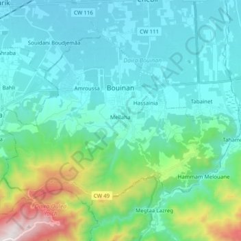
Name: Bouinan topographic map, elevation, terrain.

Location: Bouinan, Bouïnian District, Blida, 09000, Algeria (36.47167 2.91537 36.55940 3.06786)

Average elevation: 304 m

Minimum elevation: 43 m

Maximum elevation: 1,489 m

Other topographic maps

Click on a map to view its topography, its elevation and its terrain.

Sidi Serhane

Algeria > Blida > Bouïnian District > Bouinan

Average elevation: 391 m

Gear up for your next adventure:

🗺️Topographic Maps - Detailed maps to explore trails, mountains, and wilderness areas
🧰Multitool Knife - Compact and versatile tool for outdoor use
🧢Hiking Sun Hat - Wide-brimmed protection for exposed mountain ridges
🔦LED Headtorch - Bright and durable light for night activities
🔭Outdoor Binoculars - Lightweight binoculars for birdwatching and hiking

As an Amazon Associate, this site earns from qualifying purchases at no extra cost to you.