Geolocate

Kollau topographic map

Click on the map to display elevation.

About this map

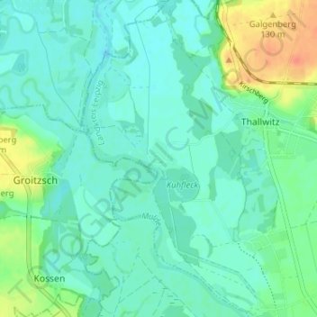
Name: Kollau topographic map, elevation, terrain.

Location: Kollau, Thallwitz, Landkreis Leipzig, Sachsen, Deutschland (51.40786 12.64002 51.44786 12.68002)

Average elevation: 110 m

Minimum elevation: 99 m

Maximum elevation: 141 m

Gear up for your next adventure:

🔭Outdoor Binoculars - Lightweight binoculars for birdwatching and hiking
🥫Freeze-Dried Meals - Lightweight, high-calorie nutrition for multi-day treks
🪑Ultralight Camping Stool - Compact seating for rest stops during long hikes
🧥Ultralight Puffy Jacket - Maximum warmth that packs down to the size of an orange
👟Sport Hiking Sandals - Breathable footwear for water crossings and camp rest

As an Amazon Associate, this site earns from qualifying purchases at no extra cost to you.