Geolocate

Guadalupe topographic map

Click on the map to display elevation.

About this map

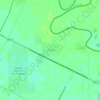
Name: Guadalupe topographic map, elevation, terrain.

Location: Guadalupe, Municipio de Matamoros, Tamaulipas, Mexico (25.90606 -97.60423 25.94606 -97.56423)

Average elevation: 12 m

Minimum elevation: 6 m

Maximum elevation: 15 m

Gear up for your next adventure:

Lightweight Backpacking Tent - Compact tent for efficient hiking trips
🔦LED Headlamp - Hands-free lighting for early morning starts or late finishes
🚑Survival Whistle - Signal for help across long distances in mountains
🪑Ultralight Camping Stool - Compact seating for rest stops during long hikes
💡LED Headlamp - Hands-free illumination for night hiking and camping

As an Amazon Associate, this site earns from qualifying purchases at no extra cost to you.