
Thank you for supporting this site ❤️
Make a donation
Make a donation
Gear up for your next adventure:
As an Amazon Associate, this site earns from qualifying purchases at no extra cost to you.
Chitre topographic map
Click on the map to display elevation.
Thank you for supporting this site ❤️
Make a donation
Make a donation
Gear up for your next adventure:
As an Amazon Associate, this site earns from qualifying purchases at no extra cost to you.
About this map
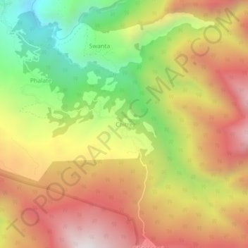
Name: Chitre topographic map, elevation, terrain.
Location: Chitre, Shikha, Annapurna, Myagdi, Gandaki Pradesh, Nepal (28.40255 83.67549 28.44255 83.71549)
Average elevation: 2,508 m
Minimum elevation: 1,845 m
Maximum elevation: 3,096 m
Thank you for supporting this site ❤️
Make a donation
Make a donation
Gear up for your next adventure:
As an Amazon Associate, this site earns from qualifying purchases at no extra cost to you.
Other topographic maps
Click on a map to view its topography, its elevation and its terrain.