Geolocate

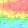
Boeuvres topographic map

Click on the map to display elevation.

About this map

Name: Boeuvres topographic map, elevation, terrain.

Location: Boeuvres, Messac, Guipry-Messac, Redon, Ille-et-Vilaine, Bretagne, France métropolitaine, 35480, France (47.75900 -1.85372 47.79900 -1.81372)

Average elevation: 38 m

Minimum elevation: 3 m

Maximum elevation: 99 m

Other topographic maps

Click on a map to view its topography, its elevation and its terrain.

Guipry

France > Bretagne > Ille-et-Vilaine > Guipry-Messac

Average elevation: 48 m

Gear up for your next adventure:

💡Solar Camping Lamp - Eco-friendly lighting for campsites
🥾Mountain Hiking Boots - High-traction boots for rocky terrain
🥾Waterproof Trail Shoes - Shoes designed to handle wet terrain
👟Sport Hiking Sandals - Breathable footwear for water crossings and camp rest
☕Camping Coffee Maker - Brew fresh coffee anywhere on the topographic map

As an Amazon Associate, this site earns from qualifying purchases at no extra cost to you.