
Jagoe topographic map
Click on the map to display elevation.
About this map
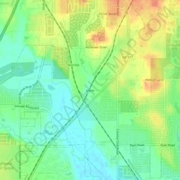
Name: Jagoe topographic map, elevation, terrain.
Location: Jagoe, Denton, Denton County, Texas, 76226, United States (33.15373 -97.16918 33.19373 -97.12918)
Average elevation: 189 m
Minimum elevation: 169 m
Maximum elevation: 214 m
Other topographic maps
Click on a map to view its topography, its elevation and its terrain.
Clear Creek Natural Heritage Center
United States > Texas > Denton County > Denton
Average elevation: 173 m