
Montello topographic map
Click on the map to display elevation.
About this map
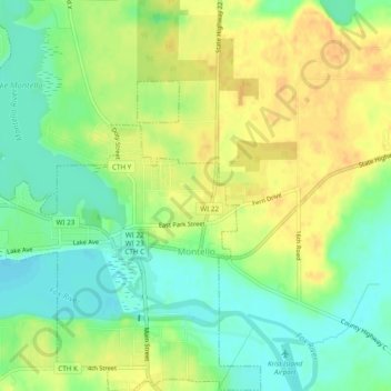
Name: Montello topographic map, elevation, terrain.
Location: Montello, Marquette County, Wisconsin, 53949, United States (43.77894 -89.35675 43.81369 -89.31191)
Average elevation: 249 m
Minimum elevation: 231 m
Maximum elevation: 266 m
Other topographic maps
Click on a map to view its topography, its elevation and its terrain.
Observatory Hill State Natural Area
United States > Wisconsin > Marquette County
Average elevation: 262 m