Geolocate

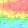
Les Ourmes topographic map

Click on the map to display elevation.

About this map

Name: Les Ourmes topographic map, elevation, terrain.

Location: Les Ourmes, Guipry, Guipry-Messac, Redon, Ille-et-Vilaine, Bretagne, France métropolitaine, 35480, France (47.81280 -1.86877 47.85280 -1.82877)

Average elevation: 33 m

Minimum elevation: 3 m

Maximum elevation: 66 m

Other topographic maps

Click on a map to view its topography, its elevation and its terrain.

Guipry

France > Bretagne > Ille-et-Vilaine > Guipry-Messac

Average elevation: 48 m

Gear up for your next adventure:

🧰Survival Kit - Essential gear for emergencies in the wilderness
⛺Backpacking Tent - Lightweight tent for long-distance hiking trips
🗺️Topographic Maps - Detailed maps to explore trails, mountains, and wilderness areas
🌡️Emergency Mylar Blankets - Compact thermal protection for unexpected nights outdoors
🚲Heavy Duty Bike Lock - Secure your bike at the trailhead or during stops

As an Amazon Associate, this site earns from qualifying purchases at no extra cost to you.