
الشلف topographic map
Interactive map
Click on the map to display elevation.
About this map
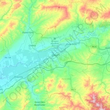
Name: الشلف topographic map, elevation, terrain.
Location: الشلف, دائرة الشلف, Chlef ⵛⵛⵍⴻⴼ الشلف, 0200, Argélia (36.00459 1.17150 36.32459 1.49150)
Average elevation: 277 m
Minimum elevation: 68 m
Maximum elevation: 869 m