Geolocate

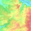
Fains-les-Sources topographic map

Click on the map to display elevation.

About this map

Name: Fains-les-Sources topographic map, elevation, terrain.

Location: Fains-les-Sources, Fains-Véel, Bar-le-Duc, Meuse, Grand Est, France métropolitaine, 55000, France (48.77136 5.10384 48.81136 5.14384)

Average elevation: 216 m

Minimum elevation: 165 m

Maximum elevation: 280 m

Other topographic maps

Click on a map to view its topography, its elevation and its terrain.
Véel

France > Grand Est > Meuse > Fains-Véel

Average elevation: 230 m

Gear up for your next adventure:

💡Solar Camping Lamp - Eco-friendly lighting for campsites
🔭Compact Binoculars - Lightweight optics for scouting trails and wildlife
🥾Approach Boots - Comfortable boots for hiking and climbing approaches
🦯Trekking Poles - Reduced impact on joints for steep topographic climbs
🧤Thermal Hiking Gloves - Grip-enhanced gloves for cold-weather altitude trekking

As an Amazon Associate, this site earns from qualifying purchases at no extra cost to you.