Geolocate

Berlin topographic map

Click on the map to display elevation.

About this map

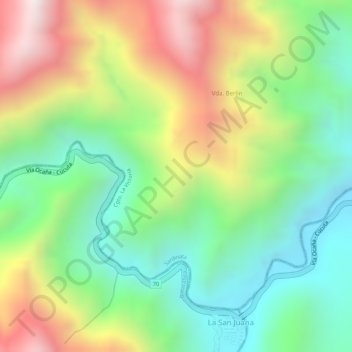
Name: Berlin topographic map, elevation, terrain.

Location: Berlin, Cgto. La Victoria, Sardinata, Norte, Norte de Santander, RAP Gran Santander, Colombia (8.07730 -72.85357 8.09730 -72.83357)

Average elevation: 647 m

Minimum elevation: 333 m

Maximum elevation: 1,077 m

Other topographic maps

Click on a map to view its topography, its elevation and its terrain.

Gear up for your next adventure:

🧥Softshell Jacket - Windproof and breathable jacket for hiking
🔋Lithium AA Batteries - Long-lasting power that performs in extreme cold
🥾Approach Boots - Comfortable boots for hiking and climbing approaches
🕯️Camping Lantern - Illuminates your entire campsite with high-efficiency LEDs
Camping Coffee Maker - Brew fresh coffee anywhere on the topographic map

As an Amazon Associate, this site earns from qualifying purchases at no extra cost to you.