Geolocate

Asahidake topographic map

Click on the map to display elevation.

About this map

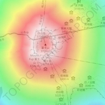
Name: Asahidake topographic map, elevation, terrain.

Location: Asahidake, Oyama, Sunto County, Shizuoka Prefecture, Japan (35.36064 138.73302 35.36074 138.73312)

Average elevation: 3,250 m

Minimum elevation: 2,646 m

Maximum elevation: 3,757 m

Gear up for your next adventure:

🧢Hiking Sun Hat - Wide-brimmed protection for exposed mountain ridges
🥾Trekking Boots - Durable boots for long-distance trekking
🧢Sun Protection Cap - Breathable cap to protect from sun exposure
🌡️Emergency Mylar Blankets - Compact thermal protection for unexpected nights outdoors
🪑Ultralight Camping Stool - Compact seating for rest stops during long hikes

As an Amazon Associate, this site earns from qualifying purchases at no extra cost to you.