Geolocate

Ramundberget topographic map

Click on the map to display elevation.

About this map

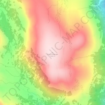
Name: Ramundberget topographic map, elevation, terrain.

Location: Ramundberget, Härjedalens kommun, Jämtland County, Sweden (62.66657 12.37584 62.66667 12.37594)

Average elevation: 964 m

Minimum elevation: 785 m

Maximum elevation: 1,087 m

Other topographic maps

Click on a map to view its topography, its elevation and its terrain.

Edsåsen

Sweden > Jämtland County

Average elevation: 445 m

Storulvån

Sweden > Jämtland County

Average elevation: 928 m

Härjedalens kommun

Sweden > Jämtland County

Average elevation: 563 m

Näkten

Sweden > Jämtland County

Average elevation: 374 m

Krokoms kommun

Sweden > Jämtland County

Average elevation: 501 m

Delsjön

Sweden > Jämtland County

Average elevation: 410 m

Krokoms kommun

Sweden > Jämtland County

Average elevation: 501 m

Finnån

Sweden > Jämtland County

Average elevation: 596 m

Strömsunds kommun

Sweden > Jämtland County

Average elevation: 475 m

Bergs kommun

Sweden > Jämtland County

Average elevation: 575 m

Östersunds kommun

Sweden > Jämtland County

Average elevation: 372 m

Storsjön

Sweden > Jämtland County

Average elevation: 404 m

Ragunda kommun

Sweden > Jämtland County

Average elevation: 315 m

Lillhärdal

Sweden > Jämtland County

Average elevation: 459 m

Bräcke kommun

Sweden > Jämtland County

Average elevation: 340 m

Rogen

Sweden > Jämtland County

Average elevation: 802 m

Sonfjället

Sweden > Jämtland County

Average elevation: 685 m

Gear up for your next adventure:

🧭Orienteering Kit - Tools for map reading and navigation in the wild
🧥Ultralight Puffy Jacket - Maximum warmth that packs down to the size of an orange
🦶Anti-Blister Balm - Prevents friction and hotspots during long ascents
🧢Sun Protection Cap - Breathable cap to protect from sun exposure
🏕️Camping Hammock - Integrated protection for sleeping between trees

As an Amazon Associate, this site earns from qualifying purchases at no extra cost to you.