Geolocate

Calvine topographic map

Click on the map to display elevation.

About this map

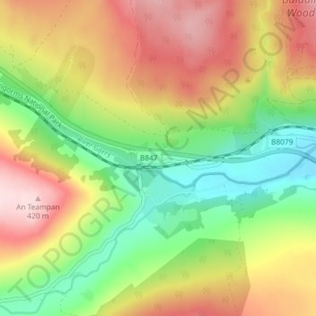
Name: Calvine topographic map, elevation, terrain.

Location: Calvine, Perth and Kinross, Scotland, PH18 5UA, United Kingdom (56.74849 -3.97730 56.78849 -3.93730)

Average elevation: 273 m

Minimum elevation: 145 m

Maximum elevation: 421 m

Gear up for your next adventure:

🔭Compact Monocular - One-handed bird watching and trail spotting
🦟Insect Repellent - Keep mosquitoes and black flies away in wooded areas
🧶550 Survival Paracord - Versatile utility cord for emergency repairs and rigging
🧊Portable Cooler - Keep food and drinks cold during outdoor adventures
🛌Down Sleeping Bag - Superior warmth-to-weight ratio for cold nights

As an Amazon Associate, this site earns from qualifying purchases at no extra cost to you.