Geolocate

Picón Rubrillo topographic map

Click on the map to display elevation.

About this map

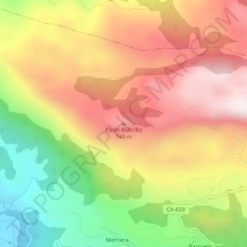
Name: Picón Rubrillo topographic map, elevation, terrain.

Location: Picón Rubrillo, Ruesga, Cantabria, 39815, Spain (43.29334 -3.50939 43.29344 -3.50929)

Average elevation: 526 m

Minimum elevation: 104 m

Maximum elevation: 887 m

Gear up for your next adventure:

🥾Trail Hiking Socks - Comfortable socks to prevent blisters and fatigue
🛏️Camping Sleeping Mat - Comfortable mats for sleeping outdoors
💡LED Camping Lantern - Illuminate your campsite with long-lasting lanterns
🔭Compact Monocular - One-handed bird watching and trail spotting
🧦Hiking Socks - Moisture-wicking and comfortable socks for long hikes

As an Amazon Associate, this site earns from qualifying purchases at no extra cost to you.