Geolocate

Magnolia topographic map

Click on the map to display elevation.

About this map

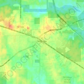
Name: Magnolia topographic map, elevation, terrain.

Location: Magnolia, Montgomery County, Texas, United States (30.18961 -95.77650 30.22826 -95.69937)

Average elevation: 77 m

Minimum elevation: 58 m

Maximum elevation: 102 m

Other topographic maps

Click on a map to view its topography, its elevation and its terrain.

New Caney

United States > Texas > Montgomery County

Average elevation: 30 m

Mount Zion

United States > Texas > Montgomery County

Average elevation: 88 m

Bobville

United States > Texas > Montgomery County

Average elevation: 75 m

Conroe

United States > Texas > Montgomery County > Conroe > Conroe

Average elevation: 60 m

Porter

United States > Texas > Montgomery County

Average elevation: 30 m

Security

United States > Texas > Montgomery County

Average elevation: 53 m

New Caney

United States > Texas > Montgomery County

Average elevation: 30 m

Lake Egypt

United States > Texas > Montgomery County > Egypt

Average elevation: 61 m

Gear up for your next adventure:

🔋Emergency Crank Radio - Weather alerts and power without needing batteries
🧴First Aid Kit - Essential first aid supplies for outdoor emergencies
🧤Insulated Winter Gloves - Heavy-duty protection for sub-zero Canadian adventures
🥫Freeze-Dried Meals - Lightweight, high-calorie nutrition for multi-day treks
🥾Hiking Boots - Sturdy boots providing ankle support and traction on rugged trails

As an Amazon Associate, this site earns from qualifying purchases at no extra cost to you.