Geolocate

Sun Valley topographic map

Interactive map

Click on the map to display elevation.

Sun Valley topographic map, elevation, terrain

Sun Valley topographic map, elevation, terrain

About this map

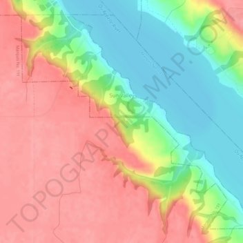
Name: Sun Valley topographic map, elevation, terrain.

Location: Sun Valley, Division No. 7, Saskatchewan, Canada (50.64404 -105.56530 50.67270 -105.51406)

Average elevation: 558 m

Minimum elevation: 507 m

Maximum elevation: 599 m

Routes: Division No. 7 GPS tracks, routes, trails, hikes

Other topographic maps

Click on a map to view its topography, its elevation and its terrain.

Moose Jaw

Canada > Saskatchewan > Division No. 7

Average elevation: 566 m

Coderre

Canada > Saskatchewan > Division No. 7

Average elevation: 692 m

Marquis

Canada > Saskatchewan > Division No. 7

Average elevation: 598 m

Riverhurst

Canada > Saskatchewan > Division No. 7

Average elevation: 599 m

Chaplin

Canada > Saskatchewan > Division No. 7

Average elevation: 672 m