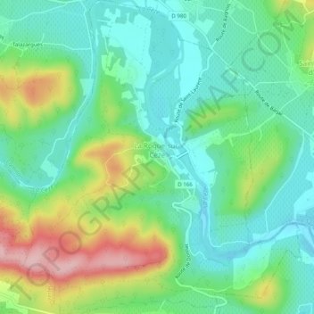
La Roque-sur-Cèze topographic map
Interactive map
Click on the map to display elevation.
About this map
Name: La Roque-sur-Cèze topographic map, elevation, terrain.
Average elevation: 109 m
Minimum elevation: 48 m
Maximum elevation: 238 m

Click on the map to display elevation.
Name: La Roque-sur-Cèze topographic map, elevation, terrain.
Average elevation: 109 m
Minimum elevation: 48 m
Maximum elevation: 238 m